This project for Virginia’s Office of Intermodal Planning and Investment (OIPI) focused on how the City of Harrisonburg can facilitate active transportation by building new roadway connections and shared use paths between neighborhoods and subdivisions. As a growing city, Harrisonburg saw a need to identify where new roads should go to provide better interconnectivity between neighborhoods, easing the traffic burden on major arterial roads and facilitating walking and bicycling.
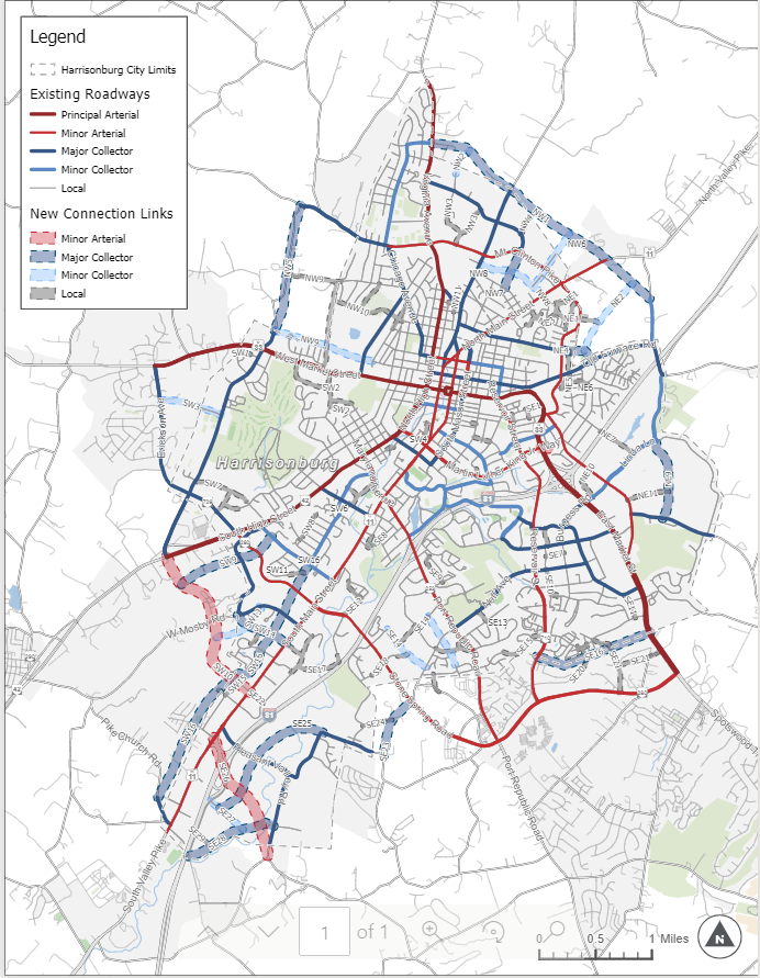
Foursquare ITP led a technical analysis to see where the lack of roadway connections impacts mobility by forcing travelers to make circuitous journeys. Our team reviewed a range of factors, such as travel flows, socio-demographics, environmental constraints, and land ownership to identify and prioritize connections.
Based on this information, Foursquare ITP provided the City a list of future roadway and multi-use path links that would improve transportation network connectivity. The final recommendations of this study provided Harrisonburg inputs to its comprehensive plan update and allowed the City to preserve the necessary rights-of-way as part of future development.
Solutions and Outcomes
- Developed comprehensive recommendations for closing gaps in the bicycle/pedestrian network in the City.
- Created inputs to the City’s comprehensive plan to preserve rights-of-way for future implementation of active transportation infrastructure.